
Members of the Steering Group of Frack Free Formby (part of The Moss Alliance) have studied a number of maps showing geological features and protection areas around Aurora’s proposed fracking site at Great Altcar. These maps have now been converted to the same scale and gradually combined in sequence, in order to demonstrate some of the constraints governing the direction of lateral drilling from the well pad.
Starting with the ‘base’ map of the area:
Applying the border of PEDL 164:
Then showing the site of the well pad and the subsurface potentially affected:
Adding the regional fault lines – note how close two major faults are to the well pad:
And then superimposing the local groundwater protection zone:
Before adding the groundwater (levels and quality) monitoring points:
Now also showing the local flood defence areas:
Before finally adding the boreholes drilled in/around the old Formby oilfield site:
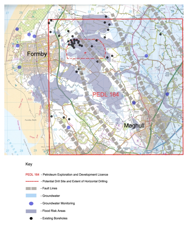
The final map demonstrates the problems and constraints of drilling lateral wells deep underground in the location chosen by Aurora.
